


Workshop and Seminar Sessions
City of Annapolis (Lisa Craig, session manager)
Weather It Together: A Community-Based Action Plan for Climate Change (Annapolis as a model)
Amanda Babson, et al. (NPS Northeast Regional Coastal Climate Adaptation Coordinator)
Site Specific Inundation Threat Assessment and Climate Change Adaptation
Roderick Scott
Flood Hazard Mitigation Toolkit
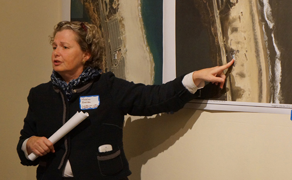
Alex Westhoff (Marin County Community Development Agency)
The Game of FloodsTM: Preservation Edition
Jennifer Wellock, et al. (Technical Reviewer, National Park Service)
Navigating Uncharted Waters: Disaster Planning for Historic Properties
Dan Nees, (Environment Finance Center, UMD) & Joanne Throwe (Deputy Secretary of the Maryland Department of Natural Resources)
Innovation in Resilience Financing
74 Bridge Street Team, Lisa Howe and Douglas Kallfelz
Case study of Christopher Townsend House and exhibition of mitigation strategies
WORKSHOP & SEMINAR ABSTRACTS
Wednesday, April 13th
9:00 a.m. to 12:00 p.m.
Various Locations (TBA)
Site Specific Inundation Threat Assessment and Climate Change Adaptation
Amanda Babson, Marilou Ehrler, and Nigel Shaw
Adapting historic structures to climate change presents multiple challenges and decision points. Identifying and acting on inundation risks to specific sites, selecting and implementing an appropriate adaption design, deciding whether to protect or to document and “let go”, requires accurate elevation data and scientifically defensible modeling of inundation threats as well as informed judgement. There is a wealth of sea level rise, storm surge and elevation data available, but it is not all of equal quality, utility or accessibility. This session will provide technical background on sources, characteristics, limitations and accuracy of elevation data (including LiDAR and high accuracy GPS) in the context of modeling sea level change and/or storm surge and identifying appropriate action. Examples from a NPS project to collect first floor threshold elevation data for all structures within several parks will demonstrate use with FEMA flood zone maps. Guidance on sea level change data and projections will help participants seeking data, evaluating models and developing alternative scenarios. A case study from Gateway National Recreation Area will demonstrate how the elevation data is being used as part of the Hurricane Sandy recovery to adapt historic buildings and prioritize restoration investments, including visualization techniques for planning and communication purposes.
Flood Hazard Mitigation Toolkit: Climate Change Adaptation of Historic Resources
Roderick and Louisette Scott
Historic buildings were built before flood maps. The historic buildings are now losing the discounts for flood insurance policies and in the future will be facing higher sea levels. The flood hazard mitigation adaptation of a historic building is important in order to reduce the risk of flooding and reduce the cost of flood insurance. The first part of this session will review the planning side of flood mitigation, like plans development, review and submission for permitting. Design review by staff and historic preservation commissions need to result in appropriate, good looking, long lasting modifications to the historic building.
The flood plain is a unique area of our communities to redevelop historic buildings. The second part of the session explores flood map elevation height requirements, civil engineering standards for designers, architectural designing, building codes and local flood ordinance requirements. Will the foundation be open or enclosed and flood venting requirements for enclosures will be examined. Project scope of work and financing will be reviewed and finally several case studies will be examined.
The Game of Floods: Preservation Edition
Alex Westhoff
Role-playing time! In this hands-on session, participants will gather around a tabletop game board and act as preservation commissioners for a fictitious historic community threatened by sea level rise. To solve for a 3 foot sea level increase, teams of 4-6 will choose strategies (protection/adaptation/abandonment), while considering community values and integrity impacts.
The Game of Floods: Preservation Edition, a collaboration between the Marin County Community Development Agency and the National Trust for Historic Preservation, is a public education activity on sea level resiliency, including traditional flood protection measures such as levees and seawalls; green infrastructure, including horizontal levees and beach nourishment; and elevating/retrofitting/relocating structures. Assets include brick/stone masonry buildings, historic waterfront districts, mixed use districts, lighthouses, cultural landscapes, and sacred archeaological sites. Cost estimates for each strategy will be provided and environmental/social/integrity impacts will inform the small group discussion with the objective of achieving consensus. Through this visual group brainstorm, participants will learn about the adaptation strategies, how to host community ‘game night,” and can even bring the game home for future use!
Navigating the Unknown: Disaster Planning for Historic Properties
Jennifer Wellock, Amanda Ciampolillo, Jenifer Eggleston, and Marcy Rockman
Do you have the right knowledge, tools, and resources in place to respond if a flooding disaster hits your community? Join experts in the fields of both historic preservation and disaster planning for this can’t miss workshop that contains vital information on how to best plan for the unexpected. This workshop will focus on using a disaster checklist as well as assessing water-related vulnerabilities. Through scenario planning exercises, the audience will learn the importance of incorporating disaster planning into local, state, or federal planning platforms. Most forms of disaster related assistance are only available to communities that have incorporated them into local, state, or federal planning platforms. A long-term strategy is needed to navigate this complicated funding and preparedness landscape to ensure a positive outcome for historic properties. In addition, the audience will be provided a basic understanding of flood insurance requirements and how recent changes to insurance premiums might impact historic properties.
Innovation in Resilience Financing
Daniel Nees & Joanne Throwe
This workshop will focus on an Environmental Finance Center project with the City of Annapolis, MD. Urbanized coastal communities like the City of Annapolis face immense resource management challenges. In particular, protecting natural, historic, and economic resources from the impacts and risk associated with sea level rise and major storm events are priorities that loom large on a physical and political landscape that is constantly evolving. There are opportunities for communities like Annapolis to coordinate resiliency implementation projects in a way that creates efficiencies and reduces costs, while at the same time filling local capacity gaps. Because of the extent to which properties in Annapolis, particularly coastal properties, are privately held rather than publicly, being able to effectively engage the private sector in the financing solution will be critical to success.
Through this project EFC will analyze the possible responses and financing scenarios to identify those with the greatest potential to improve the City’s ability to address water resource goals and requirements, as well as mitigate the impacts of sea level rise and storm events. This will result in Annapolis moving towards long-term sustainability and resiliency.
Weather It Together: A Community-Based Action Plan for Climate Change
Speakers / Facilitators
- Lisa Craig, Chief of Historic Preservation, City of Annapolis
- Karen Brown, Project Manager, City of Annapolis
- Michael Dowling, Project Architect
- John Englander & Don Bain, International Sea Level Rise Institute
- David Mandell, Deputy Director, Office of Emergency Management, City of Annapolis
- Shawn Wampler, GIS Manager, City of Annapolis
- Ross Arnett, Alderman, Ward Eight, Annapolis City Council
- Joe Budge, Alderman Ward One, Annapolis City Council
- Nell Ziehl, Chief of Preservation Planning, Education & Outreach, Maryland Historical Trust
With data indicating that flooding rates will more than double by 2050, reaching elevations exceeding 3-4 feet, the City of Annapolis is fully involved in planning to protect the historic waterfront and its architectural and archaeological heritage from damage and loss associated with rising tides and weather-related disasters.
While many cities and states are beginning to plan for sea-level rise, very few municipalities are considering the specific effects of sea-level rise on historic buildings, landscapes, and archaeological sites. Fortunately, Annapolis is, recognizing that historic architecture and local heritage are an important part of the economy that brings tourist dollars and attracts new businesses and residents.
Beginning in 2013 a core team of professionals in emergency management, GIS technology, preservation, history, architecture and flood management have worked closely with hundreds of community members and local, state and federal agencies to develop Maryland’s first cultural resource hazard mitigation plan. What has resulted is Weather It Together, a City initiative to develop a Cultural Resource Hazard Mitigation Plan and implementation strategy for the Annapolis Historic District.
This workshop is a hands-on, how-to exercise in community-based planning based on the experience of this exceptional team of local, state and national professionals. Using the FEMA model for cultural resource integration into hazard mitigation planning, attendees will leave the session with a working framework for starting the important work of hazard mitigation planning in their own community.
74 Bridge Street Team, Lisa Howe and Douglas Kallfelz
The building that inspired a conference! Explore the yet-to-be restored house of famed Newport cabinetmaker Christopher Townsend and hear from the experts charged with developing a range of mitigation strategies to protect this building from groundwater and storm flooding. Recently acquired by NRF, 74 Bridge Street sits at the lowest point in a historic coastal neighborhood and has a basement known for flooding in the middle of a summer drought. The development of the case studies has been a collaborative effort between the Newport Restoration Foundation, BCA New England (Newton, MA), Union Studio (Providence), and Mohamad Farzan, RIBA, AIA (Newport). A team of consulting architects, engineers, landscape architects, city planners, academics, and community members with expertise in preservation and mitigation of storm and water damage contributed to the project in a two-day design charrette held in January 2016.